Birri-Gubba Bindal
country
The greater Townsville – coonambelah – area is a vast landscape with large areas of wilderness
Situated at the southern end of the wet tropics, it lies within the dry tropics, and contains a wide range of environments from sea and coral to mangrove and wetland, to Eucalypt forest and savannah and at altitude even rainforest
The landscape contains a great deal of history and this website is dedicated to teasing out the evidence and listening to stories from the past, particularly at the cusp of white settlement
click on the photos below to view the whole story
The Road to Hervey’s Range
Of necessity, the exploration of the inland areas of the North Kennedy district followed the rivers, which provided water for horses and livestock. Having established the pastoral properties it was essential to have roads to access the ports in order to move produce to markets. Early in the development of the new township at Cleveland Bay a road to the interior had been identified but its establishment was not without problems.
At almost the same time as news of Townsville’s impending municipality was announced in November 1865 the government took over the survey and construction of the Range Road, which was completed in September 1866.
James Morrill
In 1846 at the age of 21 James Morrill, a sailor from Essex, was shipwrecked and disappeared from the modern world into the ancient culture of the Aboriginal peoples of northeast Queensland. He emerged seventeen years later into a colonial society rapidly encroaching upon northern Australia; a society characterised by rapacious land grabbing and ruthless treatment of the Indigenous inhabitants as it attempted to tame and exploit this foreign land.
Cape Cleveland Telegraph
Cape Cleveland lighthouse was completed and opened in 1878 on the most northern point of the Cape. A telegraph line was laid across the bay by 1880 but was replaced with a landline in 1903, and converted to telephone line in 1924.
For much of this route the track still exists and in the northern section many of the old telegraph poles can be found, some standing and some on the ground having succumbed to time and the elements.
Rock Art
‘The rock art of our people is a constant reminder of a rich and old culture passed down through the ages. This art is part of the spiritual life that told Aborigines what to do and, like every other part of their existence, there were long traditions associated with who did the painting, when they did it and the way it was done and what it meant.
The passing of the traditional ways makes it essential that rock art be recorded and studied. It is also essential that the art be looked after so that it will still be available for future generations to see how rich our culture is.’
Edward Mitchell,
Trustee, Dreamtime Cultural Centre, Rockhampton c1988
Rock Art2 !Shields
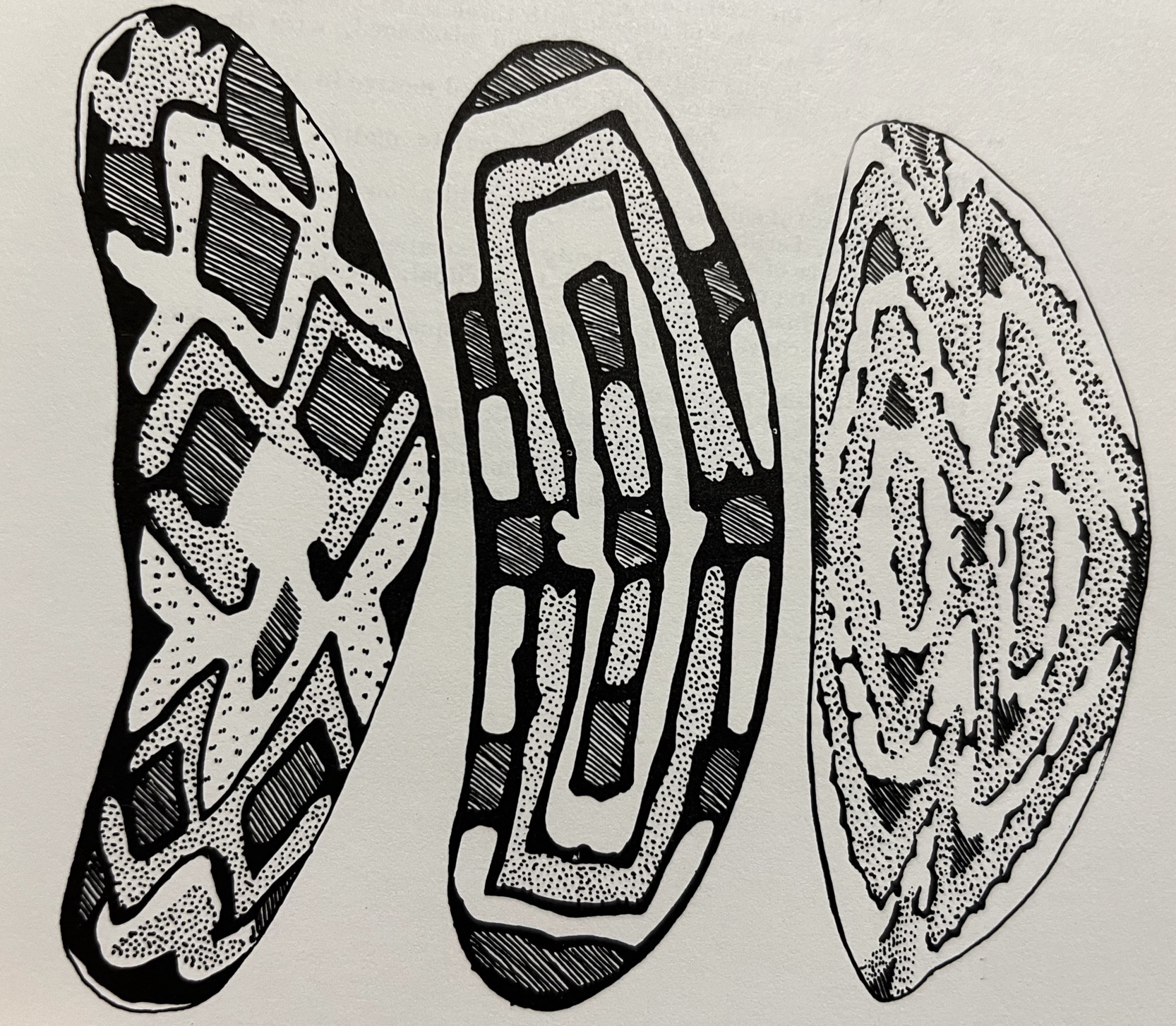
Ever since the first photographs of this rock art were taken in the 1940’s, there has been a strong inclination to interpret the images as being illustrations of rainforest shields;
In Mt Elliot National Park, Townsville, the main subject is the large shield bearing various designs typical of the district
But are they?
Rock Art3 !Churinga
There is no evidence that the painted designs of rainforest shields have informed the designs of the rock art south of Townsville, particularly because the latter usually lack the symmetry that rainforest shields always have.
One avenue is to explore ethnographic records from elsewhere and in Central Australia there are some which illustrate compelling similarities to the Townsville images. These were recorded at the close of the 19th century by Baldwin Spencer and Frank Gillen, who made pioneering accounts over a twenty-year period of the Arunta (Arrernte) people.
The Naming of Mt Elliot
At 1,210 m Mt Elliot is the highest peak in the Townsville area, seen here at centre, from Cape Cleveland. Because of its imposing presence it was frequently remarked upon by passing ships and named as early as 1816, but its spelling has always been contentious.
Charles Price
Arriving in Townsville in 1870 he set up a succession of drapery and clothing concerns but his real passion was for recording the Aboriginal language that he heard around town. A most unusual pastime for his day, he had a natural ‘ear’ and later championed the international language of ‘Esperanto’
The Peruvian
The barque ‘Peruvian’ was built in Arbroath, Scotland in 1841 for the Pitkethly family and undertook long commercial voyages in the Indian and Pacific oceans.
It foundered on Bellona Reef, 1,000 km east of what is now Mackay, Queensland in 1846. The 22 crew and passengers built a raft which, after 42 days, came ashore at Cape Cleveland. The last surviving member of the crew, James Morrill, famously lived for 17 years with the Birri-Gubba Bindal around Mt Elliot.
Ted Berry Sketchbook
In the 1930’s Ted Berry began to sketch the rock art sites he had found in the foothills of Mt Elliot. Ted was an ordinary bloke, a dockside worker, who had a great appreciation for the bush, where he spent most of his spare time. Like Charles Price he recorded what he witnessed so that we now have the benefit of this wonderful resource.


